Overview
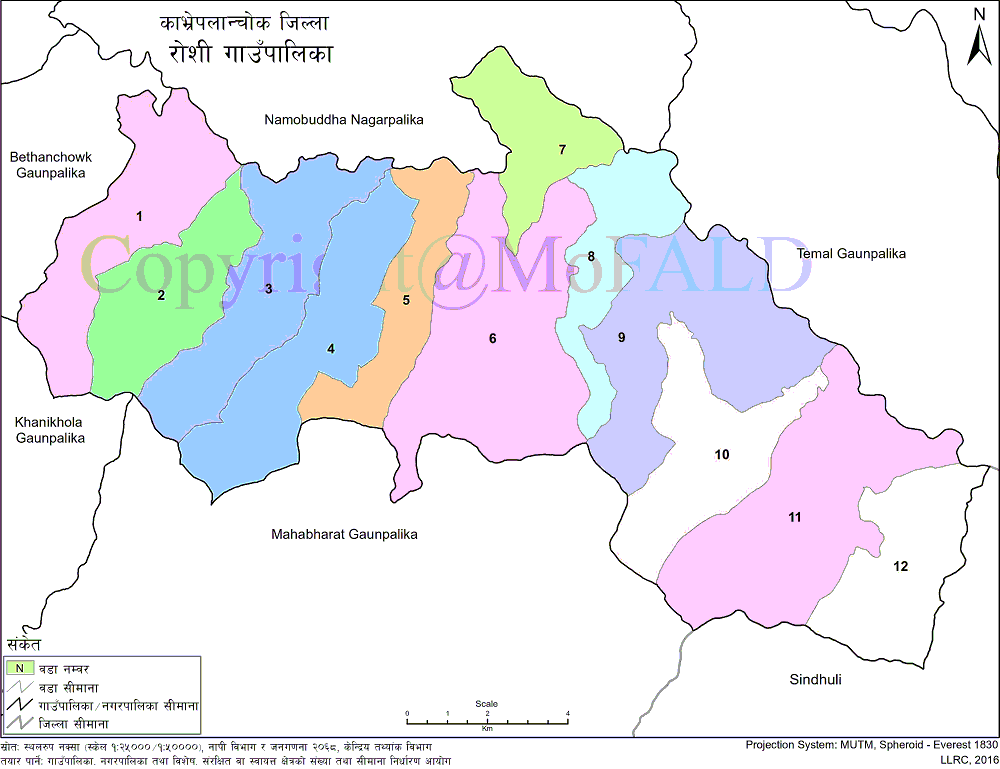
Roshi Rural Municipality (रोशी गाउँपालिका, काभ्रेपलाञ्चोक) is one of the 13 rural municipalities in Kavrepalanchok district. Gaupalika is bounded on the east by Sunkoshi Rural Municipality (Sindhuli), on the west by Namobuddha Municipality, on the north by the Timal Rural Municipality and on the south by Mahabharat and Bethanchowk rural municipalities. The total area of this rural municipality is 176 sq km and according to the 2068 census, it has a population of 28746.
This rural municipality will be an autonomous and organized body as provided by the Constitution of Nepal. The rural municipality will have its own seal. With a population density of 221 per sq km, this rural municipality is on the northern face of the Mahabharata range. This municipality has been formed by combining former 10 VDCs i.e. Kharepangu, Shikharambote, Mahadevtar, Sisakhani, Sipalichilaune, Katunjebeshi, Kharpachok, Mangaltar, Walting, and Bhimkhori.
Roshi Gaupalika is a historical and tourist importance in Kavre district. It is named after the Roshi River in this mountainous rural municipality. This rural municipality is mainly inhabited by Hindus and Buddhists. Brahmins, Chhetri, Magar, Newar, Thakuri, Kami, and Damai live in this village municipality which has a majority of Tamang caste. Citizens here have been embracing agriculture, animal husbandry, and trade as their main occupations. Full of natural beauty, this village is far ahead in terms of resources and means.
This rural municipality is gradually taking initiatives for the overall development of the region and is moving forward by preparing concrete plans and programs on an annual basis every year.
Statistics related to Rural Municipality:
Total wards: 12
Population: Female (15215), Male (13531)
Number of families: 5896
The average number of families: 4.88
Geographical Map of Roshi Rural Municipality:
Contact Address:
Location: Katunje Besi, Roshi Gaupalika, Kavre, Bagmati Pradesh, Nepal
Telephone: +977-9851201937
Email: roshi2073@gmail.com
Website: www.roshimun.gov.np


