Overview
Purbakhola Rural Municipality (पूर्वखाेला गाउँपालिका, पाल्पा) is one of the local governments of the Palpa district, which was formed on 12th March 2017. Pubakhola was formed by merging 6 VDCs (Siluwa, Jalpa, Ringneraha, Devinagar, Birkot, and Heklang). Purbakhola Gaupalika is surrounded by hills and mountains. Purbakhola Rural Municipality is spread over an area of 138.05 sq. Km.
The population of this rural municipality is 19589. The center of this rural municipality is in the office of the former Ringnerah VDC. There are 42 educational institutions including community and private secondary schools in all its wards.
The "Elephant Lake" at the top of Palpa falls under this Rural Municipality. The land here is surrounded by hills. The Magar Municipality is predominant in this Rural Municipality and is to some extent inhibited by Brahmins, Chhetris, and Dalits. The people here are enjoying their religion in harmony with each other.
Among the religious places here are Churebaraju of Siluwa, Jalpadevi of Jalpa, Shiva Temple of Ringnerah, Bhanumata Devi of Devinagar, and Akala Devi of Birkot, and Baraha Devi of Heklang. It is believed that there is a copper mine in Siluwa's copper mine village and it has been reported that there are many potential mines in Hattilek.
Total area: 138.05 sq. Km.
Total households: 4,251
Total population: 19,589
Number of women: 10,972
Number of males: 8,617
Border
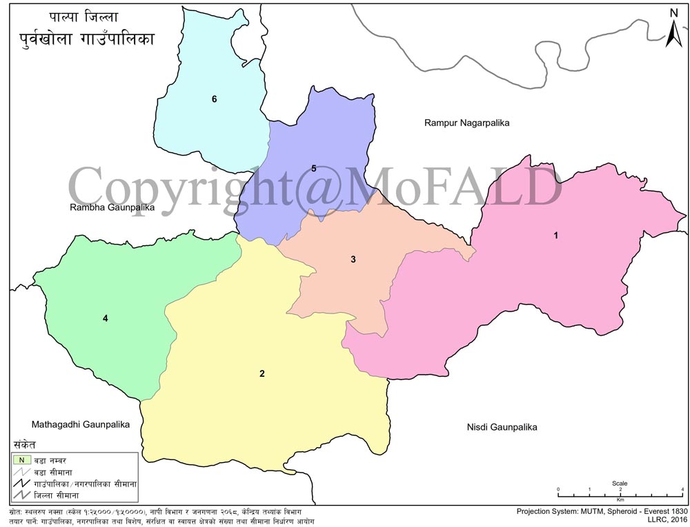
East: Rampur Municipality and Nisdi Gaupalika
To the west: Mathagadhi and Rambha Gaupalika
North: Rampur Nagarpalika and Rambha Gaupalika
In the south: Nisdi and Mathagarhi Gaupalika
Temperature
Maximum: 25 Degree Celcius
Minimum: 6.5 Degree Celcius
Latitude: 27.812418
Longitude: 83.779079
Geographical Map of Pubakhola Gaupalika, Palpa:
 :
:
Contact Details:
Purbakhola Rural Municipality
Office of the Rural Municipal Executive, Ringnerah, Palpa, Lumbini Pradesh, Nepal
Phone: +977-9857068575
Email: info@purbakholamun.gov.np
Website: www.purbakholamun.gov.np


