Overview
The total area of Mahabharat Rural Municipality (महाभारत गाउँपालिका, काभ्रेपलाञ्चोक) located in the southern part of the Kavrepalanchok district is 186 sq. Km. Its total population is 18,283. It is a very backward place economically, politically, and socially. This place, which is considered to be very remote and inaccessible from the geographical point of view, does not even have the facility of a motor road connecting to the district headquarters till now.
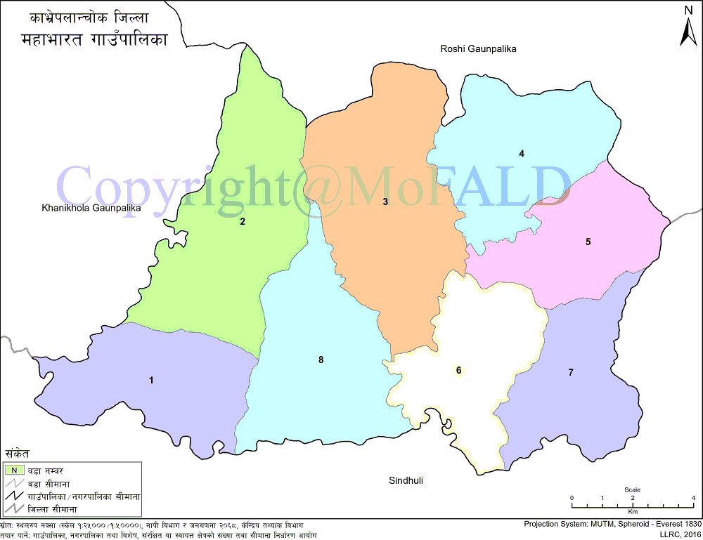
Mahabharat Gaupalika, which has it's own geographical, cultural, and community identity, is mainly inhabited by Tamang, Magar, Bahun-Chhetri, Majhi, Newar, Dalit, Pahari and other communities. Gokule, Phoksingtar, Budhakhani, Bankhuchaur, and Ghartichhap VDCs of the old structure. Roshi Rural Municipality is surrounded by hills on the northern border of this rural municipality, Sindhuli district on the east, Sindhuli district on the southeast, and Khanikhola Rural Municipality on the west.
Between the center of the Mahabharata, the Bankhu center, and the high sea level of Kavre, approximately 5,000 m. Tarakhase Lake, which is at a height, belongs to this Gaupalika. The village is bounded on the south by the Kokhajor River, on the east by the Rampur River of Sindhuli and on the west by the Chaukhola River. The Mahabharat, named after this rural municipality, is the natural heritage and beauty of this rural municipality. Complete dependence on agriculture. The main source of income of the people here is agriculture. From this, the people here make a living.
Geographical Map of Mahabharat Rural Municipality:
Contact Address:
Location: Devitar, Mahabharat Gaupalika, Kavre, Bagmati Pradesh, Nepal
Telephone: +977-9851226876, +977-9843251594
Email: ito.mahabharatmun@gmail.com
Website: www.mahabharatmun.gov.np


